 TikTok
 Instagram
 YouTube

 Home
Home
 Top Influencers
 Explore


PaM GIS
GPS based geospatial data collection and display app.
Contains ads

100+
Total Global Downloads-
Bundle ID
com.dnovichman.pam
-
Developer
PaMGIS -
Category
Maps & Navigation -
Price
Free -
Update Time
Jul 2, 2025 -
0 Ratings
0
-
Bundle ID
com.dnovichman.pam -
Developer
PaMGIS -
category
Maps & Navigation
-
Price
Free -
Update Time
Jul 2, 2025 -
0 Ratings
0
 Screenshots & Media

 App Info
 ***********
 Description
GPS based geospatial data collection app for field surveyors, property evaluators and authorities involved in planning, mapping and revenue generation.The PaM app is one of the software offered by Planning and Mapping Limited for solving geospatial issues relating to addresses, roads and lands. The ppp helps in the digitisation and relay of geospatial information to the end user.
The app currently supports KML file format and only a single data type (Point, LineString, LinearRing) is allowed to be contained in the file. In the instance where multiple types are detected, preference pf choice is LinearRing, LineString then Point.
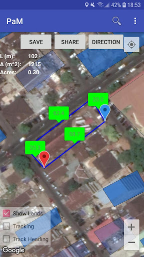
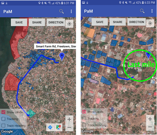
Last mile navigation when no driving direction can be found is supported by the app. This is done by enabling tracking mode, then saving (local) or sharing and later reloading it via the “Load” menu.
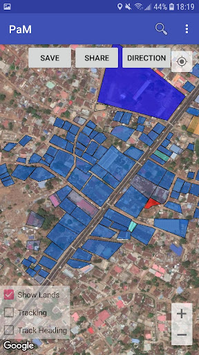
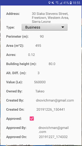
The app can be used as a measurement tool as it provides distance, perimeter, area and acreage measurements of paths (roads) and polygons (land) in realtime and displayed on the screen.
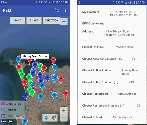
PaM app is the primary data collection tool for our cloud based GIS system with complimentary software that can be downloaded from https://www.pamgis.com/index.php/download/ and the data made available in realtime on https://maps.pamgis.com/pam_2dmaps.html and in our location services and other services that can help in emergency response. Currently, we allow saving data on our cloud system for only specific countries and regions which can be configured in the “Settings”.
As a whole, the Planning and Mapping software and app solve the following problems
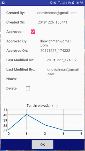
* A cadastre system for addresses, roads and lands
* Safe and secure data with historical track changes
* Revenue generation and collection
* A survey mobile app that can be used either online or offline
* A GIS software that is OGC compliant and supports CSV, shapefile and KML formats and PostGIS, SPatialite and MySQL databases
* Real-time data across all platforms
* City planning
* Analysis of distribution of lands, roads and addresses
* Detection of land and road encroachments in real-time
* Emergency response using weather, land and road information
Policies on using our app can be found at https://www.pamgis.com/index.php/app_policy/
For more information, please visit our website https://www.pamgis.com or our Youtube Channel https://www.youtube.com/channel/UCPgQ7JZ154ZY8V_EE-21yHw. Alternatively, you can contact us at [email protected].

 Popular IAP
--
 Version History
Ranking Trend
Last 7 Days
Last 30 Days
 Customize
Last 7 Days
Last 30 Days
Customize
Last 7 Days
Last 30 Days
Customize
Last 7 Days
Last 30 Days
Customize
Download Trend
Last 7 Days
Last 30 Days
Last 90 Days
Customize
More by【PaMGIS】
| # | App | App Category | App Price | App Initial Release Date | |
| 1 |
|
PaM GIS
PaMGIS
|
Maps & Navigation | Free | Dec 16, 2020 |