
 Home
Home


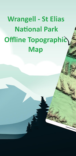
Wrangell -St Elias Offline Map
Wrangell - St Elias National Park Offline Topographic Map. No Int...
Contains ads

1+
Total Global Downloads-
Bundle ID
com.xd_geospatial.wrangell_st_elias
-
Developer
XDivide Geospatial -
Category
Maps & Navigation -
Price
Free -
Update Time
Jan 1, 1970 -
0 Ratings
0
-
Bundle ID
com.xd_geospatial.wrangell_st_elias -
Developer
XDivide Geospatial -
category
Maps & Navigation
-
Price
Free -
Update Time
Jan 1, 1970 -
0 Ratings
0
 Screenshots & Media


 App Info
 ***********
 Description
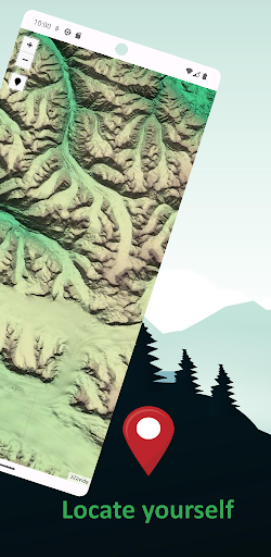
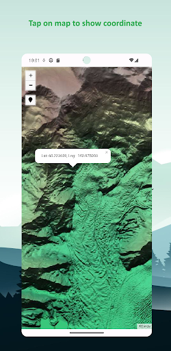
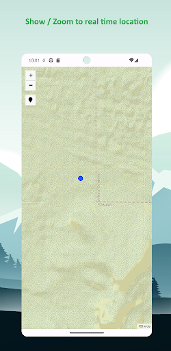
Designed with simplicity in mind, this app offers an intuitive user interface that enables you to quickly and easily find information about surroundings, without any prior technical knowledge or experience.The app offers offline topographic map of Wrangell - St Elias national park, data used in this app meticulously provided and maintained by 3D Elevation Program (3DEP) - consist of lidar point clouds and digital elevation models at various horizontal resolutions.
As a testament to our commitment to utilizing cutting-edge technology, we proudly leverage the Leaflet JavaScript library – a project born in Ukraine. It delivers a seamless user experience that empowers you to explore and discover the world with ease.
This app is the embodiment of our unwavering commitment to making the world a better place, and we are honored to provide a powerful platform that equips you with the tools and information needed to navigate and explore the surroundings with confidence and clarity.

 Popular IAP
--
 Version History
| Version | Time |
| Jan 1, 1970 | Jan 1, 1970 |
| 2.0 | Apr 14, 2025 |
| 1.0 | Aug 30, 2023 |
Preparing
Ranking Trend
Last 7 Days
Last 30 Days
 Customize
Last 7 Days
Last 30 Days
Customize
Last 7 Days
Last 30 Days
Customize
Last 7 Days
Last 30 Days
Customize
Download Trend
Last 7 Days
Last 30 Days
Last 90 Days
Customize